
Viewing a GeoServer Layer in Google Earth
This section covers the task of quickly viewing a layer in Google Earth.
Note
The Google Earth binary is not included in the Windows training package so you have to download and install it. For the pourpose of the training exercises it is also suggested to de-activate all the standard Google Earth overlays.
Navigate to the Layer Preview.
From the “All formats” menu select the KML (network link) item next to geosolutions:bplandmarks layer.
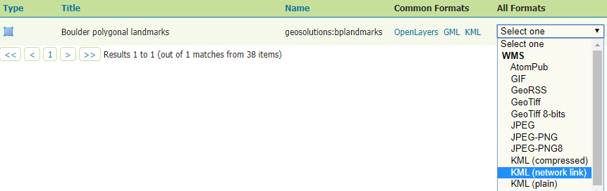
Generating KML with the map preview
In the resulting dialog choose to Open with Google Earth and OK.
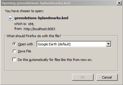
Opening KML from GeoServer with Google Earth using the Firefox browser
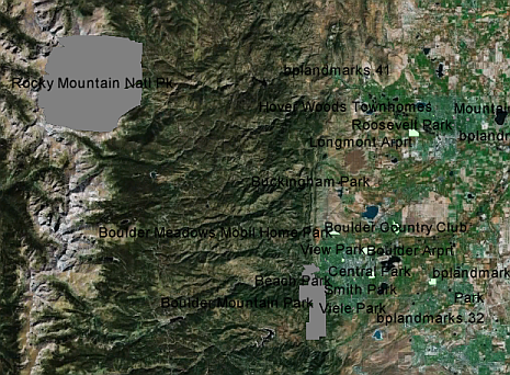
Viewing the Boulder polygonal landmarks layer in Google Earth
Click on a polygon to view its placemark description
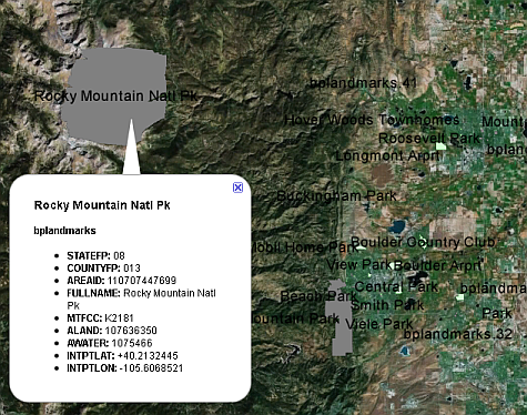
Viewing a placemark description
This section covered the simplest method of viewing GeoSever data in Google Earth.