
GeoServer WPS Implementation and Demo Builder
Lets take a look at some specific features and capabilities of the GeoServer WPS Implementation.
Inputs and Outputs
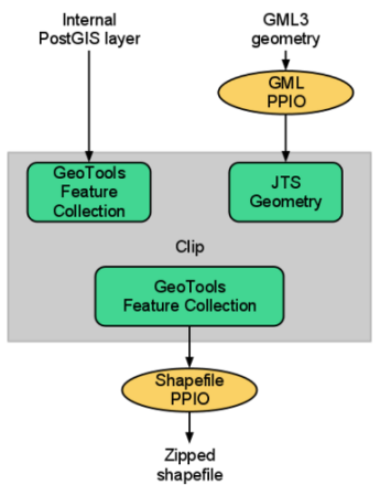
GeoServer provides the capability of converting I/O Parameters (literals, layers, ...) into Java Objects and viceversa through the PPIOs (ProcessParameterIO). Pluggable converters trade between the java object and the serialized representation.
GeoServer also has the ability of getting an internal resource straight reading from the source bypassing the standard conversion process (e.g. GML encoding/decoding), leveraging on all the available optimizations.
- These are the supported “primitives” IO Parameters:
- Numbers:
byte,short,int,long,float,double, anyNumbersubclass, properly mapped in XML types StringsandCharSequencein generalDate,Time,Timestamp- Coordinate reference systems (both
EPSG:xxxxandurn:...forms) URLsRange(min -> max)- Interpolation method
- Numbers:
- These are the supported “Complexes” IO Parameters:
- Geometries
GML 2GML 3WKT
- Vectors
- WFS 1.0 Collections
- WFS 1.1 Collections
GeoJSON- Zipped Shapefiles
- Rasters
- ArcGrid
- GeoTiff
- Unreferenced PNG/JPEG
- Others
SLD 1.0- OGC Filter (1.0, 1.1)
- CQL Filter
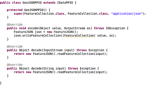
The Complex IO Parameters are easily extensible thanks to an Open API. Check below an example of a custom GeoJSON PPIO:
Note
The JTS methods are mapped as Processes through a Static annotated class. That means that they are directly available as WPS Processes.
Demo Builder
The Demo Builder is a nice GUI feature provided along with the WPS Plugin that allows to quickly build WPS Execute Process requests through a step-by-step input form.
The Demo Builder provides:
- A list of available processes
- A direct link to the DescribeProcess for the selected one
- Ability to: set the input parameters, and automatically build the ExecuteProcess document or execute it directly
- All in one form
Go to the WPS request builder . You can reach this page also clicking on
Demos > WPS Request Builder.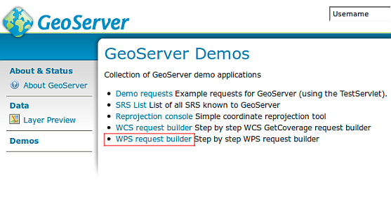
Choose JTS:buffer from the first combo box and fill the
geometryanddistanceinput parameters as depicted in the figure: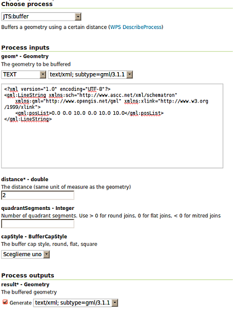
Copy the xml snippet below and use it as the input geometry
<gml:LineString  xmlns:gml="http://www.opengis.net/gml">
        <gml:posList>0.0 0.0 10.0 0.0 10.0 10.0</gml:posList>
</gml:LineString>
Click on Execute process button to directly execute it and get back the result, or on Generate XML from process inputs/outputs to let the Demo Builder generate the ExecuteProcess document for you.
Warning
The Demo Builder has some limitations:
- It is not able to access to remote resources.
- For multi-valued inputs, it does not allow to specify more than one value.